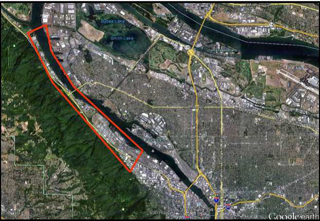

During summer 2018, the Portland City Club’s Earthquake Resiliency Advocacy Committee (CCERAC) and the city of Portland’s Bureau of Emergency Management (PBEM) requested that Oregon Solutions conduct an assessment to determine potential avenues for collaborative action that might increase resiliency of the Critical Energy Infrastructure (CEI) hub located in northwest Portland.
According to a February 14, 2017, Portland City Club report, “approximately 90 percent of the liquid fuel for the entire state of Oregon and 100 percent of the jet fuel for Portland’s airport comes through the CEI hub.” But the tanks on this site are vulnerable to a Cascadia Subduction Zone event (CZE) given their age and that they were constructed on seismically vulnerable soils susceptible to liquefaction, which could potentially cause the tanks to “sink, split, tilt or leak.” Additionally, risks to the environment, life, safety, and property at and near the site from a CZE are unclear.
Oregon Solutions interviewed stakeholders and completed an assessment report delivered to the Governor.