 The Cardwell Hill Regional Conservation Planning Strategy was a cooperative, voluntary approach to landscape-scale restoration and management that worked across the ownership boundaries of many participating landowners. It was based in the upper Marys River hills region, which is composed of a network of public and privately-owned parcels in an area of high biodiversity value. The project was spurred by a set of common goals generated by landowners and the watershed council, in the interests of protecting and restoring habitat and water resources in the region.
 Developed by the Marys River Watershed Council, the project aimed to bring the council and Benton County together with private and public landowners on a coordinated, landscape-scale conservation plan. The plan was conceived of as being achieved by using state-of-the-art landscape analysis and community planning techniques that balance conservation of habitat with preservation of landowner lifestyles and values. It was intended to further develop the concept of a “Livable County” by providing environmental protection, economic development, and community services for its citizens. There was an additional goal to have the project serve as a replicable model for identifying areas of high biodiversity value throughout the county where private landowners could work voluntarily to preserve and enhance those features, without prescriptive measures by regulatory authorities.
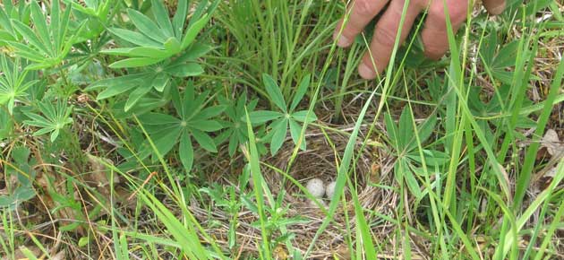
 This project was one of the first of its kind to attempt to incorporate voluntary protection for rare, threatened, or endangered species while respecting landowner decisions regarding use of their land. The Cardwell Hill area is composed of rare oak woodland, oak savanna, riparian, and wetland habitats. These habitats, which have undergone dramatic decline in the Willamette Valley ecoregion, harbor many of the focal species identified in the Oregon Comprehensive Wildlife Strategy (OCWS). The project area was in one of the conservation opportunity areas identified in the OCWS. Additionally, much of this area has been identified as proposed critical habitat for several endangered species. Voluntary conservation of these species, and the opportunity areas within which they reside, is a key implementation strategy for the OCWS.
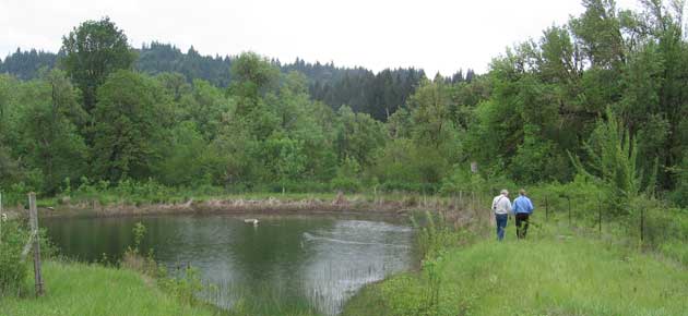
The Marys River Watershed Council received funding support from the Oregon Watershed Enhancement Board to develop the first phase of restoration projects in the upper Marys with eight participating landowners, collectively owning up to one square mile of land base. The governor’s designation of the project as an Oregon Solutions project attracted additional resources as well as broader community outreach and support.
Declaration of Cooperation (PDF)
Additional Resources
Marys River Watershed Council website